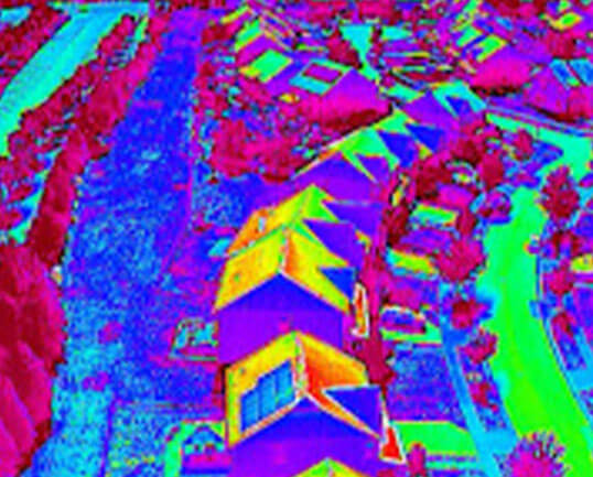
Thermal Capabilities & Inspections

Applications of Thermal Drone Inspections
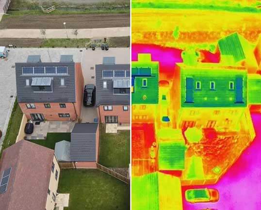
- Roof Inspections: Detect leaks, insulation gaps, and structural weaknesses.
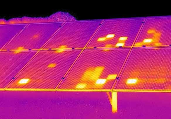
- Solar Panel Analysis: Identify faulty or underperforming cells to improve efficiency.
- Electrical Systems: Locate overheating connections, transformers, or power lines.
- Mechanical & Industrial Equipment: Spot overheating motors, bearings, and machinery.
- Building Envelope Analysis: Highlight energy loss points to reduce heating/cooling costs.
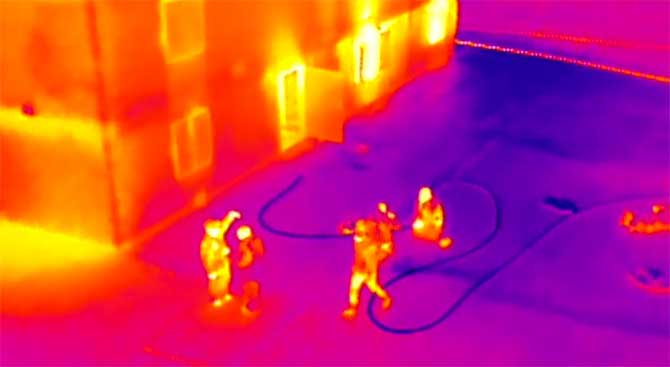
- Emergency Response: Assist first responders in locating hotspots, missing persons, or fire risks.
Benefits of Choosing SkyHawk
- Non-invasive inspections – no scaffolding, ladders, or manual roof climbing required.
- Rapid deployment and reporting – faster turnaround compared to traditional methods.
- High-resolution thermal imaging for accurate diagnostics and documentation.
- Cost savings – early detection prevents expensive repairs and downtime.
Why Choose Us for Orthomosaic Mapping in Virginia
At SkyHawk Survey Solutions, our orthomosaic mapping services give you a clear, accurate, and actionable view of the terrain—empowering you to build smarter, respond faster, and plan with confidence. Whether you’re managing infrastructure, assessing damage, or developing land, we deliver precision aerial data you can rely on.
What We Deliver
Our orthomosaic maps are processed using advanced photogrammetry software to generate:
- 2D high-resolution orthoimagery with centimeter-level detail
- Georeferenced TIFF and JPG files for integration with CAD, GIS, and mapping software
- Map overlays with property boundaries, elevation lines, or infrastructure layouts
- Digital surface models (DSMs) and contour line exports for topographic analysis
- Color-corrected, high-fidelity maps suitable for inspections, site plans, and visual reports
We provide clients with access to maps via downloadable links, interactive portals, or direct file transfers in the formats you need.
Key Benefits of Orthomosaic Maps
- Accurate to scale – supports distance, area, and volume measurements
- Updated visual data – capture changes across time and site conditions
- Fast delivery – maps processed within 24–72 hours, depending on size and complexity
- Non-invasive – no ground disturbance or boots on the ground
- Cost-effective – more affordable and safer than traditional survey methods for large sites
Applications Across Industries
Our orthomosaic maps serve clients in both public and private sectors, including:
Construction & Site Development
- Pre-construction site planning and earthwork analysis
- As-built documentation and progress tracking
- Quantity takeoffs and stockpile volume calculations
Land & Asset Management
- Boundary identification and encroachment verification
- Infrastructure and utility network overlays
- Vegetation indexing and erosion monitoring
Agriculture & Environmental Monitoring
- Crop health analysis (when paired with NDVI sensors)
- Watershed and drainage analysis
- Reclamation, restoration, and environmental compliance
Emergency Management & Disaster Response
- Rapid post-disaster mapping
- Flood modeling and debris assessment
- Real-time situational awareness for response planning
Contact us today to schedule your orthomosaic drone mapping consultation and receive high-resolution, georeferenced aerial maps for your project.
What is an orthomosaic map?
An orthomosaic map is a high-resolution, georeferenced aerial map created by stitching drone images together, offering true-to-scale, top-down views for precise measurements and spatial analysis.
What are the benefits of using orthomosaic maps?
Orthomosaic maps provide accurate, georeferenced data that supports distance, area, and volume measurements. They are non-invasive, cost-effective, and can be updated frequently, making them ideal for construction, land management, and environmental monitoring.
How accurate are orthomosaic maps?
Our orthomosaic maps are accurate to the centimeter level. With advanced photogrammetry, we ensure precise spatial data that can be used for detailed planning, topographic analysis, and decision-making.
Can orthomosaic maps be used for environmental monitoring?
Yes, orthomosaic maps are ideal for environmental monitoring, including vegetation analysis, watershed and drainage studies, and erosion monitoring. They provide clear, accurate visual data for assessing land conditions and changes over time.
What industries benefit from orthomosaic maps?
Orthomosaic maps are valuable for industries like construction, real estate, agriculture, environmental monitoring, emergency response, and land management. They provide precise, actionable insights for project planning, asset tracking, and real-time analysis.